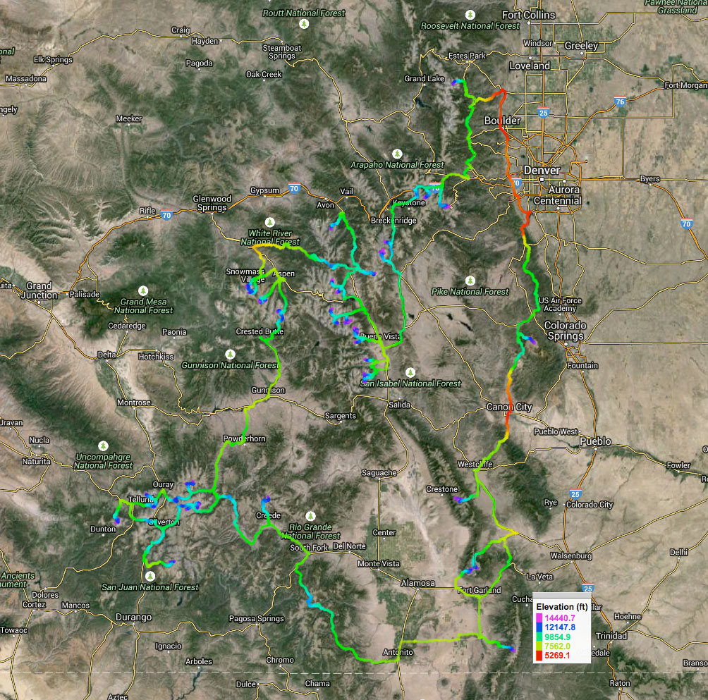
 Credit to Justin Simoni for making this map, which is mostly analogous to the route I'll follow. After my hike of the Appalachian Trail in 2015, I was pretty much immediately in search of "the next big thing." Not that I had to undertake anything right away, but I like to always have something on my plate to work towards. When, in 2016, Joe Grant completed the Tour de 14ers, it caught my attention. He spent a month enchaining all the 14ers in Colorado by riding his bike from trailhead to trailhead, camping there, then summiting on foot. All self-supported and self-powered. Here was a project I could get behind. The idea lingered for some time, ripening and fermenting in my brain bucket. When I discovered, quite happily, that I would be able to finish my undergraduate degree in only 7 semesters, the excuse was made and plans were loosely laid. By eloping for what would have been my final fall semester, I could give myself a window of time at the tail end of summer to accommodate my the tour, rather than rush back to start school in late August. Due to the delicacies of Colorado mountain weather, the tour de 14ers would be ideally undertaken during the second half of summer; give Ullr the necessary time to melt the snow, endure the afternoon monsoons, and beat the Fall snow and ice. Luckily for me (but not many others), the winter of 2017-2018 in Colorado was rather dry; it appears that Ullr, in some rare display of favor for me (or was it displeasure at Coloradans?), had lifted his hoary hand from that typically frosty winter wonderland that is the Colorado Rockies. As Odysseus thanked Athena for favoring him on his return to Ithaca by sending the smoke of burned meat upward to Olympus, I gave Ullr His proper due by carving up the bounty of snow He instead bestowed upon Vermont, taking care to to slash and spray enough snow skyward to please the Holy Hammer-dump Himself. 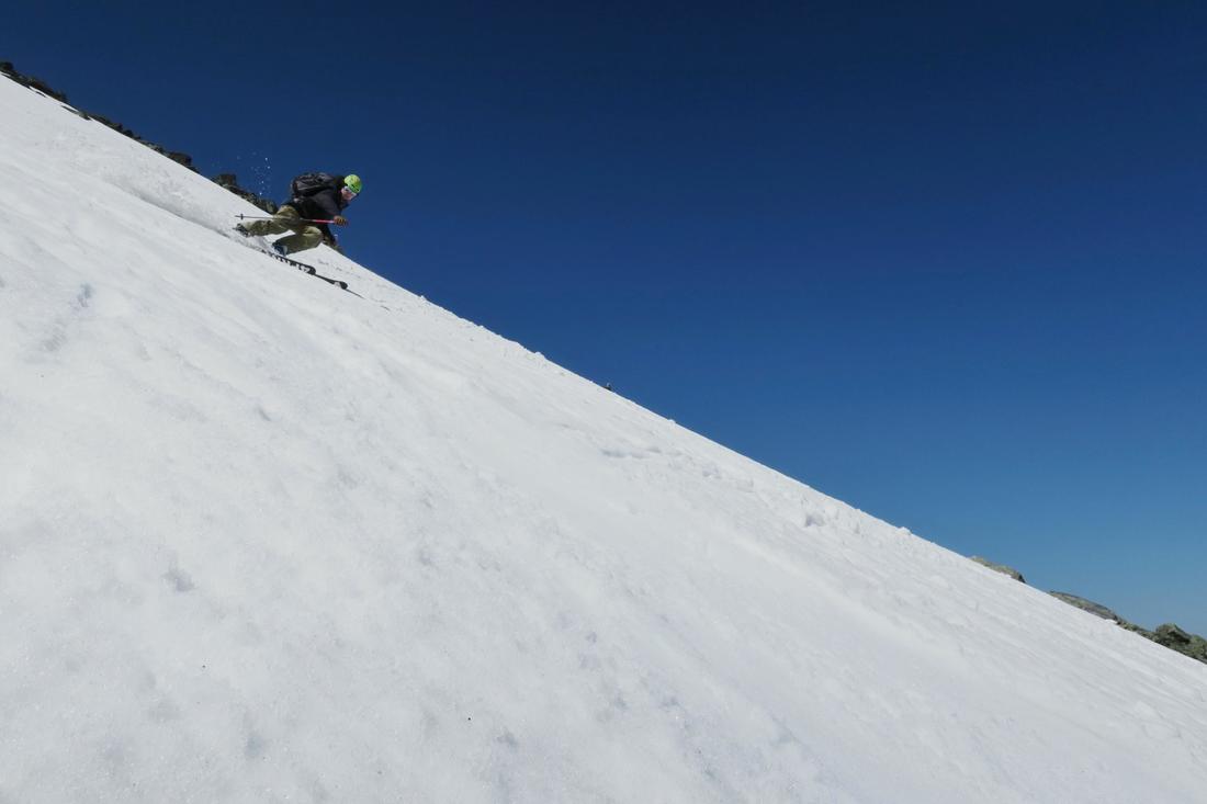 Thanks be to the divine Dude for these dank Spring turns. PC: Merrick Gillies But I digress. While doing my homework on the tour, I discovered that Joe Grant had been inspired by a certain Justin Simoni, who completed the same Tour in 2014. On his website (http://longranger.justinsimoni.com/tour14er/), I discovered a veritable trove of useful information. Really, anything one could want for planning out their own Tour de 14ers. I reached out to him and Joe Grant, who were both quite gracious and helpful in sharing some stories from their Tours, as well as useful beta that a Vermont boy could not hope to discover remotely. Big thanks to both of you. With such help, combined with careful academic planning and good training among the snowy mountains throughout the Winter and Spring, the plan became a reality. On July 11th or thereabouts, I'll embark on my own Tour de 14ers from Leadville, Colorado following these simple guidelines. Style is everything. -John Paul ZillerSelf powered. Bikepacking it is! Like Justin and Joe, I will be riding my bike from trailhead to trailhead, town to town, and so forth. I'll ascend and descend the mountains on foot, always returning back to my bike. Unless something goes wrong (my bike is stolen, a handicapping injury), I don't plan to ride in a car, train, plane, hovercraft, dirigible, tank, flying carpet, submarine, spacecraft, or use a jetpack during the Tour. There is something compelling about covering vast distances under my own power, even if it's slow. Self supported. As per the typical long distance self supported guidelines, I would use only those services that are available to everyone (stores, motels, trail magic, etc) to remain true to style. However, I will not be going for an FKT on the route, or even a comparatively fast time. The goal is completion, not duration. As such, I think it much less imperative to so stringently observe the hard and fast rules of self-supportedism at all times. The vast majority of the time, I plan to follow this style. But, I have tentative plans to meet several friends throughout the duration of my Tour. It would be very rude of me not to accept a beer from them, don't you agree? Absolutely no muling, though. I'll always carry all of my own gear, and don't wish to slackpack any sections (if you'll pardon the thru-hiking term). 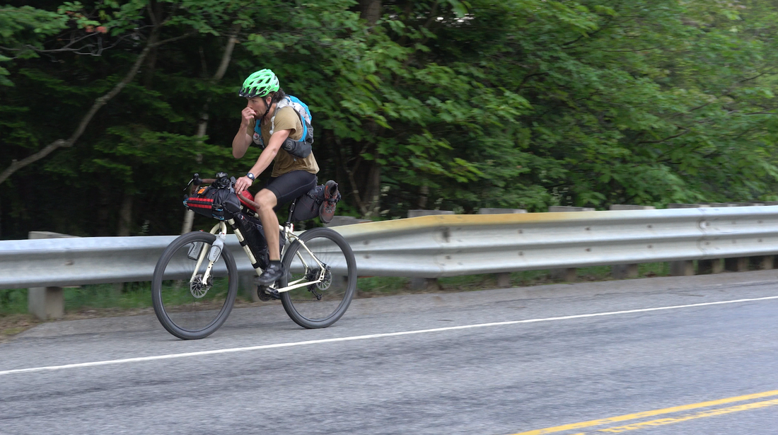 Me on the rig. PC: Colby Yee One big-ass loop. I'll start in Leadville, and, by gum, I'll end in Leadville. I'll be leaving my truck at a friend's house in Leadville for the duration of my tour. Unless someone steals my bike, or it breaks in half, the only way back to my truck is to ride! We're gonna need a bigger dinner. Though the idea is to do all of the 58 accepted 14ers in Colorado, I'm purposefully leaving out Culebra. Why? Bread. Duckets. Shekels. Moola. Rubles and Drachmas. Culebra sits most unfortunately on a private ranch, which charges prospective hikers (last I heard) $150 for a single day permit, non transferable. For such a complex trip like this, it would be a scheduling nightmare (just listen to Justin and Joe's stories about the Race for the Permit). $150 is a lot, too. Most importantly, the idea of shelling out such a quantity of dough for a single peak is pretty sour. A modest fee for upkeep and conservation I would understand, but this? As such, I plan to do the other 57 accepted peaks. Gear. For you gear dweebs, here are the main components of my kit.
That Colorado 3,000 foot rule. Yeah, that's for people in cars. I'm gonna be pedaling and hiking my ass everywhere. If I can ride my bike above that magic 3,000 foot vertical buffer below a summit, I shall certainly do so, haters be danged. Why? Wherefore doest thou such a heady undertaking, Rowan?
Thank you, to everyone who has helped to get me to the start. My parents, grandparents, and other relations, helpful advisors at UVM, Joe Grant, Justin Simoni, and anyone else I'm forgetting. You know who you are. Following along.If you wish to follow along, do so via my instagram. I'll be posting regular photo updates throughout the tour.
I shall leave you with some choice words: lemon curry?
0 Comments
It was time to test all that fitness that I had supposedly been squirreling away into my little fitness piggy bank all winter long, lapping the Burrows Trail on Camel's Hump because it's one of the few steep trails that gets packed down enough to be runnable throughout the winter, and is close to Burlington (whence I come). Despite the repetition factor, I enjoyed getting to know each rock, tree, and turn throughout the months, and was able to log some seriously fast descent times when conditions were ideal for such tom-foolery. Turns out there's a small contingent of like-minded souls, as I would repeatedly see the same folks out engaging in their ablutions at the alter of vert. So, I though, what better way to celebrate the proper start of ice-and-snow-free alpine running season than to do some more laps! This time, instead, on Mt. Adams in the White Mountains. I worked on the Randolph Mountain Club's trail crew in 2016 and more or less fell in love with the northern Presidential Range. To my mind, you'd be hard pressed to find anywhere more rugged or beautiful in the East than the many ravines, ridges, and sinuous trails that over the past 130 years have sprang up to meander to, up, over, around, behind, and under every imaginable point of interest on the north slopes of Madison, Adams, and Jefferson. Adams itself, the proudest peak in the area, is large enough to accommodate several different paths to its summit, each nestled in its own nook, cranny, or ridge on the mountain's craggy bosom. I had done many of these options separately while working for the RMC, and felt that the time had come to string several together and really give my ankles a solid thrashing. 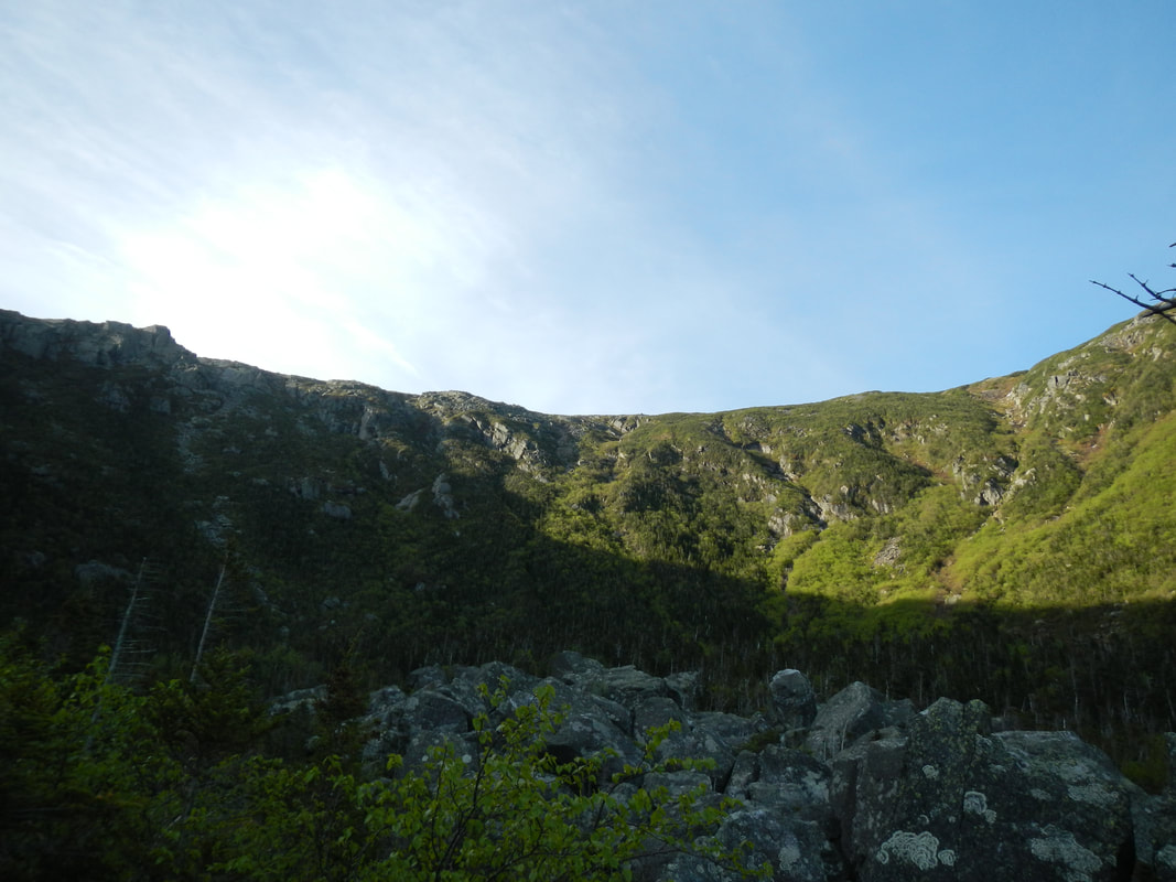 The headwall of King Ravine under the first sun rays. Captain's Log: SS FlagellationJune 8, 2018 9:30pm: Engaged in acrobatics to insert myself onto the sleeping platform in the bed of my truck. Looking forward to a good night of sleep with some river noise in the background. 11:30pm: Car pulls into trailhead parking. In almost entirely empty lot, car parks not 2 feet away from my truck. Driver proceeds to make much noise in the arrangement of a rustic sleeping situation in his small ford sedan. 11:50pm: Finally, everything settles down next door. June 9, 2018 4:45am: I awake, make breakfast, and begin the opening and closing of the truck doors in slow but steady succession. Small revenge taken. 5:40am: No sign of movement next door in sedan. I drive away for Mt. Adams. 5:55am: Arrival. I hastily apply shoes and sunscreen. 5:59am: Fill my water bottles. 6:00am: Still filling water bottles. I miss my intended start time. Oops. 6:55am: Arrival at the floor of King Ravine. Scenery beheld. 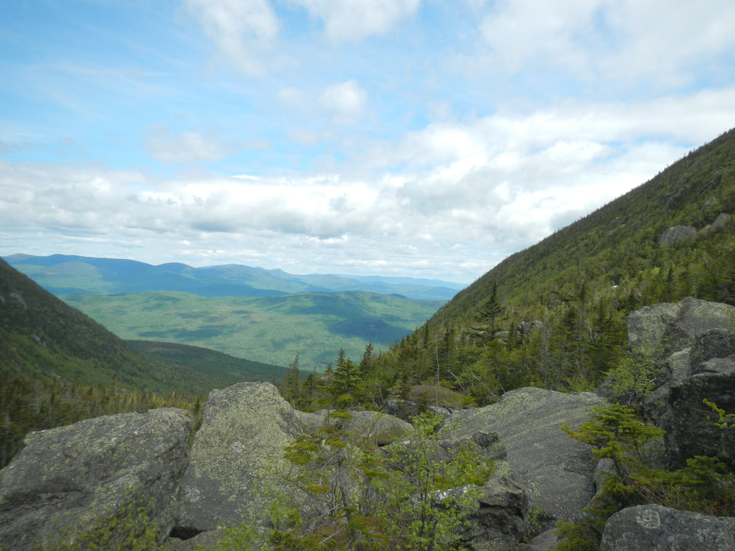 Looking north out of King Ravine. 7:10am: Questioning decision to climb Great Gully Trail first, which gains about 1,700ft in 0.9 miles. 7:40am: Summit reached. A fresh breeze encourages further movement. 9:00am: Back at truck. Shoes changed, water refilled. 10:00am: Having learned nothing, yours truly now finds himself at the base of the King's Slide, which gains about 1,350ft in 0.5 miles. 10:00am - 10:35am: Vigorous practice of the uphill wobble technique. Ahh, the great outdoors. 10:50am: Summit reached for second time. Breeze is more insistent. Cowering behind leeward rock, fine views enjoyed by all. 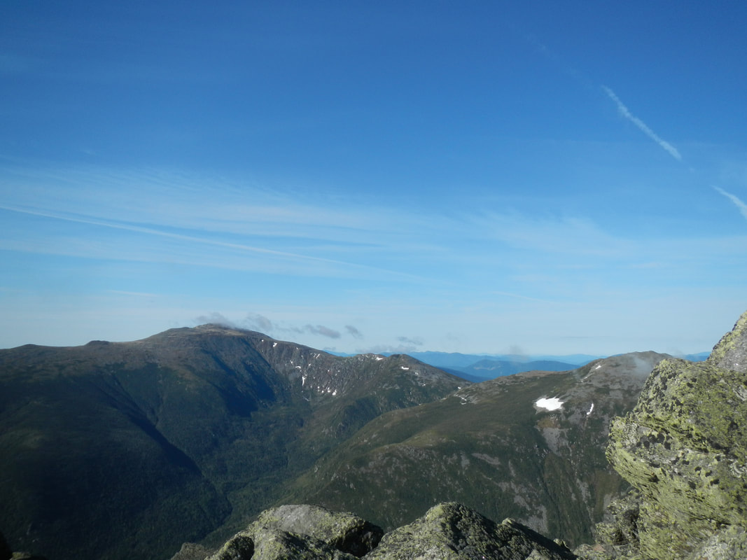 OMG is that Tuckermans Ravine?!?!? 10:55am - 12:15pm: Second descent via Valley Way, determined by The Council of Elrond to be the smoothest way down. Elrond is wise but unlearned in northeastern mountain running. Rocks. 12:15pm: Nobody greets me with a steak hot out of the pan, as they did for Chris Goetze when he did 4 laps in a day on Adams in 1958. Hardtack it is. *upon departure, cue internal dialogue* 12:30pm: Oh god, here we go again. 12:31pm: Hey at least we didn't take the turn for Airline. 12:50pm: I'm sweating ****s. I should take another salt tab. *Due to use of profanity, we have dismissed the internal dialogue, and will return to our regularly scheduled programming.* 2:20pm: Third summit. Visible fatigue. L-R: First, second, and third summit. 2:25pm: Began final descent. Thoughts of hot, savory food. 2:45pm: The medicine men working at Madison Hut revived me with a slice of bread. Mountain hospitality for all! No surprise dessert though. 3:55pm: Having smelled the barn, as they say, ran the last stretch quite fast in order to get to my folding chair faster. Food and drink consumed in mass quantities. SHOW NOTES 13,900 ft of gain, 9h54, 28 miles. Very technical terrain.
Upon rounding a corner at one point while descending, I was hailed by a passing hiker; "Look at this crazy asshole who's running this shit!" Many happy returns, sir. There seemed to be a bunch of other folks out doing laps as I kept seeing them multiple times. I had a good time chatting and running with several of them. |


